The Provinces of Tokugawa Japan
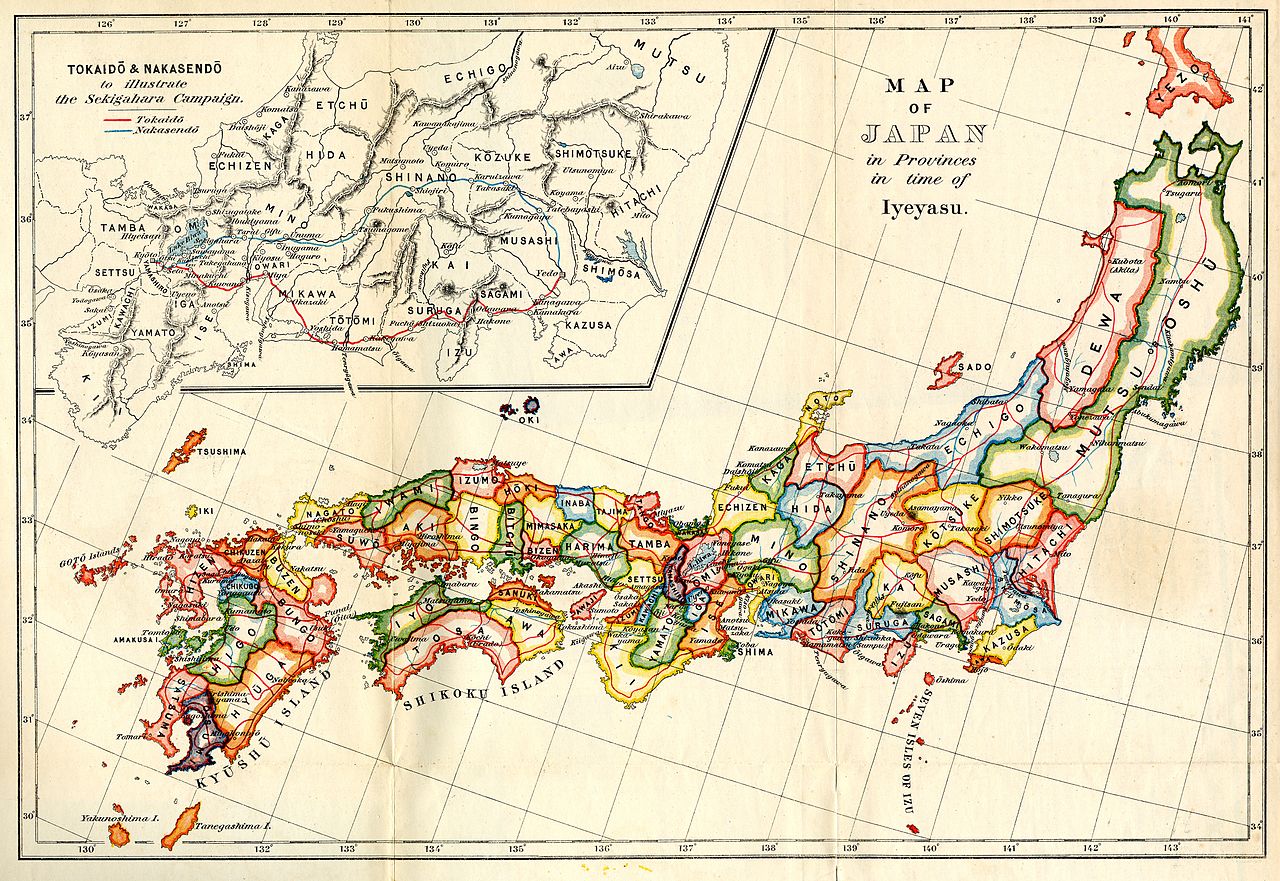
A map of the Japanese provinces as they stood in the time of Ieyasu, the arrangement the Tokugawa shogunate governed for over 250 years.
Tokugawa stability rested on geography as much as law. Domains were distributed so that potentially hostile lords were surrounded by reliable ones, held land far from the capital, and were required to spend alternate years in Edo with their families left behind as sureties. The map is, in effect, a diagram of a control system that kept the peace for two and a half centuries. Read the full story in our article on How the Tokugawa Shogunate Crafted Japan’s Edo Period Stability.
CC BY-SA 3.0 — source (Wikimedia Commons). Free to reuse under the stated licence.