Map of the Silk Road
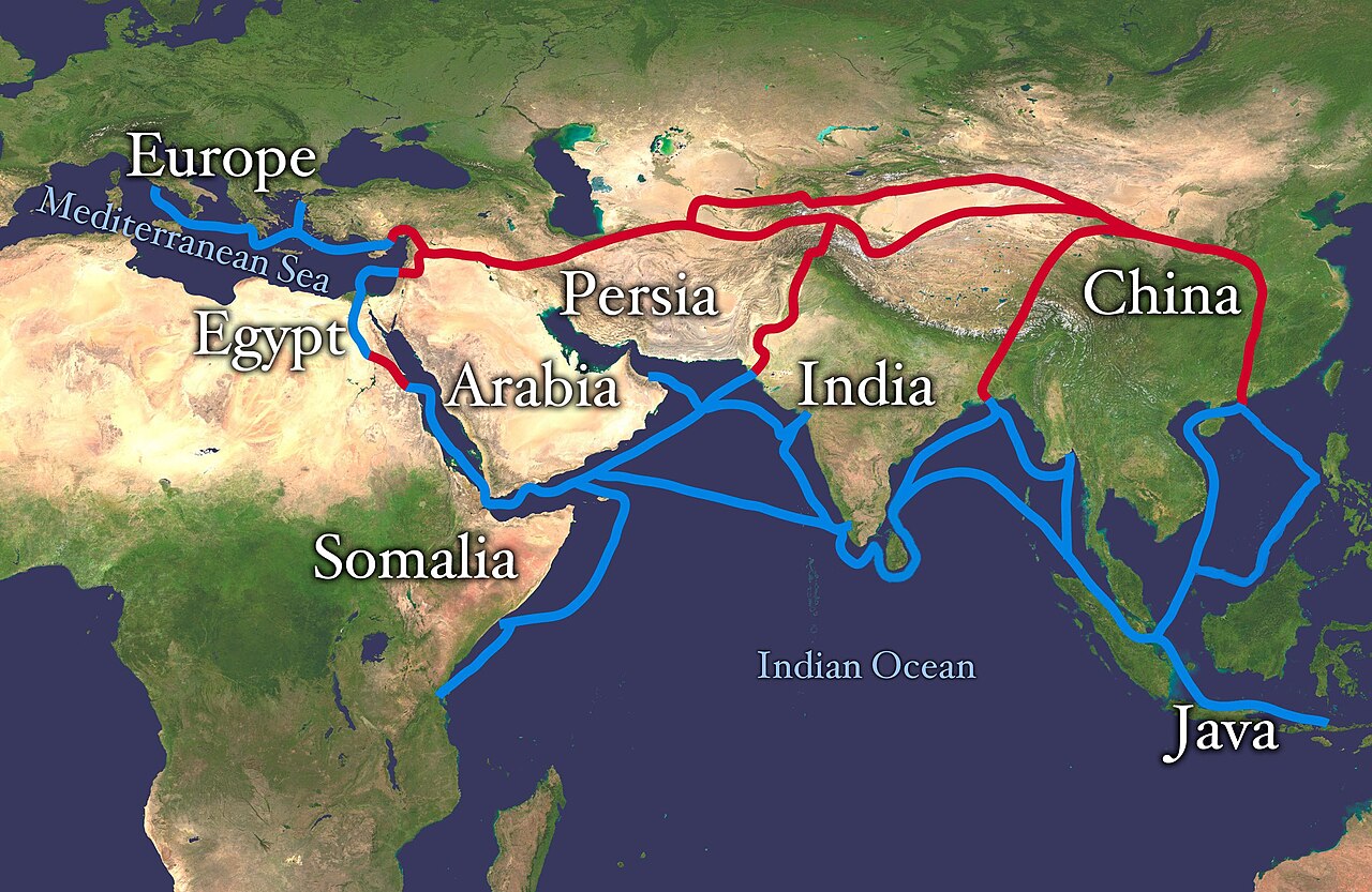
The overland and maritime routes of the Silk Road, linking China with Central Asia, the Middle East and Europe.
Less a single road than a shifting web of caravan tracks and sea lanes, the Silk Road carried silk, spices, paper, glass, faiths and plagues between East and West for well over a millennium. The overland corridors through the Tarim Basin and Persia flourished from the Han dynasty onward and reached their safest, busiest era under the Mongol peace of the 13th–14th centuries — the world Marco Polo travelled.
Public domain — source (Wikimedia Commons). Free to reuse under the stated licence.