Map & timeline
How Guilds Built Medieval Europe, 1100–1600 — Map & Timeline
€ 9.95 VAT included · digital download, nothing is shipped
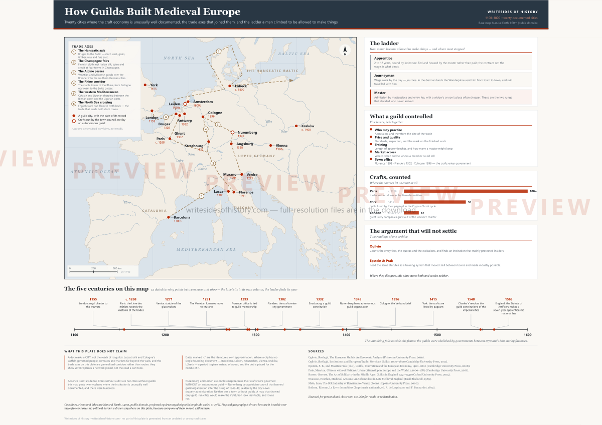
Twenty European cities where guild institutions are unusually well documented, each with a dated fact and a note on how firm that date is — plotted on a latitude and longitude grid with no coastline and no border, because between 1100 and 1800 every border in the frame moved and a map that drew one would be choosing a year in silence.
What you get
- Print edition: A2 landscape, vector PDF — sharp at any size you print it
- A4 landscape PDF for a classroom printer
- Screen edition as SVG and as a 2,400-pixel PNG
- Twenty cities, eighteen dated milestones, a scale bar computed from the projection itself
- Full bibliography and an explicit panel of what the plate does not claim
For: Teachers, students, and anyone who wants the institution on one sheet rather than in twenty tabs.
Every article on this site stays free. Buying is how the writing gets paid for; reading never costs anything.